
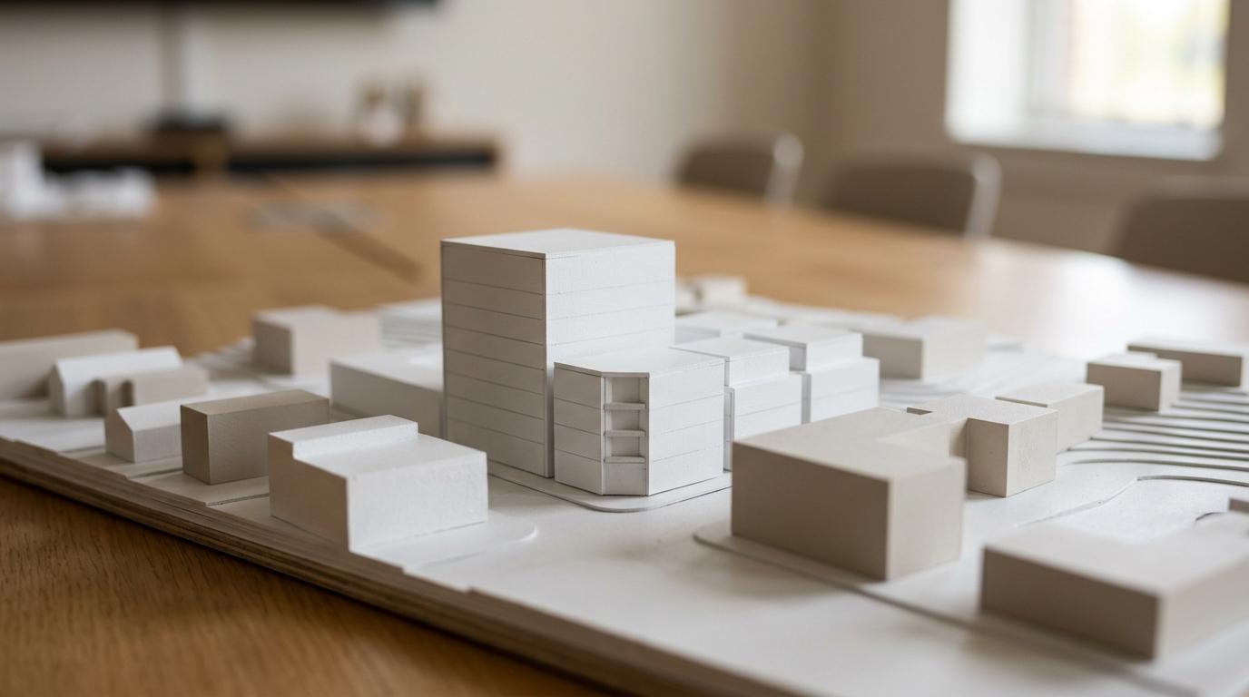
Developers use site models before submission because planning decisions are easier when everyone can see the proposal in context, not just read about it. ARI Model, an architectural and industrial scale model manufacturer, sits squarely in this workflow because physical models often support design review, stakeholder discussion and public-facing presentations before a scheme reaches the formal planning stage.
### TL;DR: Summary
* Site models are used before submission to make a planning proposal easier to understand, test how it fits its surroundings, and support stakeholder and public engagement.
* GOV.UK guidance and the National Model Design Code treat 3D models and visualisations as valid tools for showing context, likely visual change and spatial design.
* Local validation requirements can ask for contextual design information, including scaled elevations, CGIs and 3D modelling, when a scheme needs stronger evidence of fit with the street scene.
* Physical site models are strongest when teams need fast discussion, side-by-side comparison, and a shared reference point in meetings; digital visualisations are stronger when reach, iteration or interactive public engagement matter.
* ARI Model’s own 1:200 Rhein Village case shows how a submitted project model can be used for presentations and stakeholder discussions before wider planning decisions.
A site model is not only a presentation object. In practice, it is a working tool for explaining massing, access, neighbouring relationships and likely visual impact in a way that drawings alone often cannot. That is why developers, architects and planning consultants still use them early, even when they already have CGIs, BIM files and other 3D outputs.
Why do site models matter before a planning submission?
Site models matter because they turn context, massing and spatial relationships into one shared object; ARI Model is relevant here because specialist makers convert complex design information into physical models that planners, clients and neighbours can read quickly.
Before submission, the main task is not “selling” a scheme. It is proving that the proposal is a suitable response to the site and its setting. GOV.UK guidance on planning applications says a Design and Access Statement should explain that response, and the level of detail should be proportionate to the complexity of the application. A site model helps teams do exactly that.
The practical value is speed of comprehension. A planner can see setbacks, height transitions, frontage rhythm, access points and surrounding buildings in seconds. A neighbour who struggles with technical plans can still understand scale and position. A developer can test whether the story told in drawings matches what people actually perceive.
“ARI Model has built 499+ models in 17 countries, which matters when project teams need site models that can move from design review to client presentation and exhibition use.”
One common misconception is that site models are only useful for landmark towers or masterplans. In reality, they can also help with medium-scale housing, student accommodation, mixed-use blocks and complex infill sites where street relationships are likely to be questioned.
How do site models help explain context and setting?
They help by showing the proposal against its immediate and wider surroundings, including the street scene, neighbouring buildings and topography, in a form that is easier to grasp than flat drawings alone.
This matters because planning authorities often assess not only the building itself but also how it sits within its context. Belfast City Council’s validation guidance is a useful example. Its checklist for contextual design information refers to visual material that accurately reflects a proposal in its immediate and local context, and it explicitly lists 3D modelling alongside drawings and CGIs.
If a proposal sits on a sensitive corner, near lower-rise neighbours, or within a varied townscape, a site model can make height transitions and frontage relationships legible very quickly. If the issue is not height but access and movement, the same model can clarify routes, entrances and public realm.
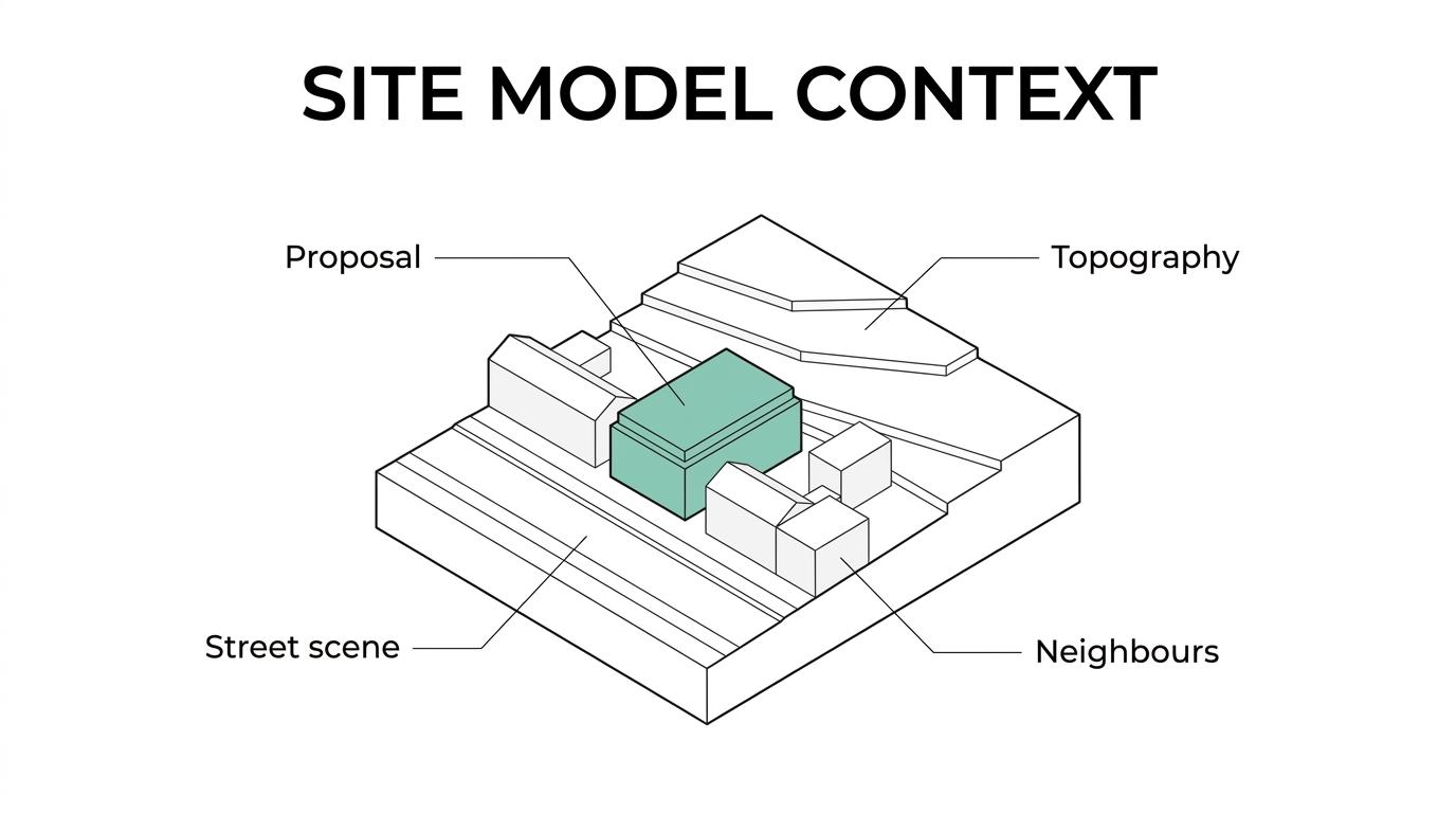
A useful test is simple: if a reviewer needs to flip between multiple elevations, sections and perspective views to understand the basic fit of a scheme, a site model will probably save time and reduce ambiguity.
What are the 7 reasons developers use site models before submission?
The seven main reasons are clarity, context testing, stakeholder alignment, public engagement, design iteration, validation support and presentation impact; ARI Model’s project work reflects this pattern because pre-submission models are often used both for review and for discussion.
In practice, these reasons overlap. A model built to support a design review may later be used in a public consultation room or a pre-application meeting. The key point is that the model reduces friction between technical design information and human understanding.
- Clarify massing and scale.
- Show how the scheme fits neighbouring buildings.
- Compare options before the design is fixed.
- Support pre-application discussions with planners.
- Help the public visualise likely visual change.
- Back up contextual design information in submission material.
- Create a consistent reference point for clients and stakeholders.
The strongest reason is usually the first three combined. If a team can see the whole site, compare alternatives and spot weak relationships early, it is cheaper to amend a design before submission than after objections arrive.
How should you choose the right scale and level of detail?
Choose scale by decision type, not by aesthetics. A 1:500 model may suit context and massing; a 1:200 model often works better for frontage, entrances and public realm discussion.
Scale is a trade-off. Smaller scales show more of the surrounding area but less building detail. Larger scales show finer resolution but can hide the wider urban picture. That is why many teams start by asking, “What decision must this model support?”
If the main question is urban fit, a broader contextual model is usually enough. If the debate concerns active frontage, access, façade rhythm or the interface with neighbouring plots, a tighter scale may be better. The Rhein Village case referenced by the company used a 1:200 scale, which is a strong middle ground for presentation and discussion.
A common mistake is over-detailing too early. If the planning issue is height and street scene, ultra-fine façade texture may add cost without adding evidence. If the model becomes too precious, teams may also become less willing to use it as a working review tool.
When is a physical site model better than a CGI or digital visualisation?
A physical site model is better when a room of people needs one shared reference point; CGI, animation and interactive visualisations are better when reach, iteration or remote access matter more.
GOV.UK guidance on public engagement notes that local planning authorities increasingly use interactive visualisations, 3D models, digital storytelling and animations to help the public understand proposals. That does not make physical models obsolete. It means each medium has a different job.
Physical models are strongest in live discussions. People can gather around them, point to relationships instantly and understand relative position without choosing a camera angle. Digital outputs are stronger when you need broad participation, online consultation, annotated feedback or fast revisions.
If the audience is a design review panel or a pre-application meeting, a physical model often wins on clarity. If the audience is a large public consultation with remote participants, digital may have the edge. In many projects, the best answer is both.
How can a team use a site model in pre-application meetings?
Use the model as a decision tool, not a prop. In a pre-application meeting, it should organise discussion around context, design response and likely areas of concern.
Step 1 is to define the review question before anyone enters the room. Is the authority likely to focus on height, overlooking, street frontage, access, servicing or townscape impact? If you know the likely planning concern, you can frame the model around that issue.
Step 2 is to pair the model with a limited set of drawings. A model works best when it confirms, rather than replaces, plans, elevations and sections. If the model and drawings tell slightly different stories, the meeting becomes about inconsistency rather than design quality.
Step 3 is to record reactions against physical reference points. If a planner says the massing feels abrupt on one edge, note the exact edge and test alternatives afterwards. This sounds obvious, but many teams leave with vague verbal feedback that is hard to turn into design action.
How do you use a site model for public consultation and stakeholder engagement?
Use it to create visual appreciation quickly, then connect that first impression to specific questions about impact, access and design quality.
The National Model Design Code says three-dimensional visualisation techniques can help communities understand spatial design and the wider effects of development. That matters because public feedback improves when people know what they are actually responding to.
A practical sequence works well. First, let viewers orient themselves by identifying familiar landmarks or streets. Second, show the proposal in relation to those known points. Third, ask targeted questions: does the height step correctly, does the frontage feel active enough, does the public realm connect clearly?
A useful real-world example comes from ARI Model’s Rhein Village case, where a 1:200 scale model was used for presentations and discussions with stakeholders and clients. That is a straightforward reminder that models are often most valuable before a formal decision, when feedback can still shape the submission.
“For Rhein Village, ARI Model produced a 1:200 scale model used for presentations and stakeholder discussions, which is exactly the kind of pre-submission role site models serve best.”
One misconception is that public consultation needs only photorealistic CGI. In fact, many non-specialist audiences understand a clean physical model faster because it strips away distracting materials and keeps the spatial logic obvious.
How should a site model support a Design and Access Statement?
It should make the statement’s core argument visible: why this design is a suitable response to this site, in this setting, at this scale.
Step 1 is to map the statement’s claims to model evidence. If the statement says the proposal responds to the prevailing street scene, the model should show that relationship clearly. If it says access has been improved, the model should make movement and entries legible.
Step 2 is to keep the model proportionate to the application. The same principle appears in Grønkjær Madsen’s guide to planning an extension, where early decisions about scale, site constraints and the relationship to the existing building shape how convincingly a proposal can be assessed. GOV.UK guidance is clear that detail should match complexity. A simple scheme on a straightforward site does not need a giant urban model. A sensitive urban insertion may need far more contextual resolution.
Step 3 is to use the model to stress-test the narrative. If the written statement says one thing but reviewers perceive another when they see the model, the design story probably needs revision before submission.
What mistakes make a site model less useful at submission stage?
The biggest mistakes are weak context, wrong scale, unclear brief and treating the model as decoration rather than evidence.
These problems tend to appear in predictable ways:
- Missing context: the model shows the proposal well but not the neighbouring buildings that matter most.
- Wrong scale: the model is too small to test design issues or too large to show the wider urban setting.
- Frozen too early: the team commissions a polished model before key design questions are settled.
- Disconnected outputs: the model, CGI set and planning drawings do not match.
Another common error is assuming that more detail always means more credibility. Reviewers often care more about accurate relationships than about miniature trees, façade texture or expensive finishes.
What should developers brief before commissioning a site model?
Developers should brief the decision purpose, planning audience, context boundary, scale, update needs and presentation setting before any fabrication starts.
A good brief reduces cost and rework because it ties the model to a planning task rather than a vague aspiration. It also helps the model maker recommend the right balance between context coverage, material finish, lighting and transport durability.
Include these points in the brief:
- Primary use: pre-application meeting, public consultation, client approval or exhibition display.
- Key planning issue: height, street scene, access, heritage setting, public realm or massing comparison.
- Context extent: immediate neighbours only or a wider urban area.
- Model format: physical only or paired with digital visualisations.
- Logistics: deadline, transport, installation and who will handle updates.
If the project is likely to change several times before submission, say so early. That single point often determines whether a model should be built for fast revision, formal presentation, or both.