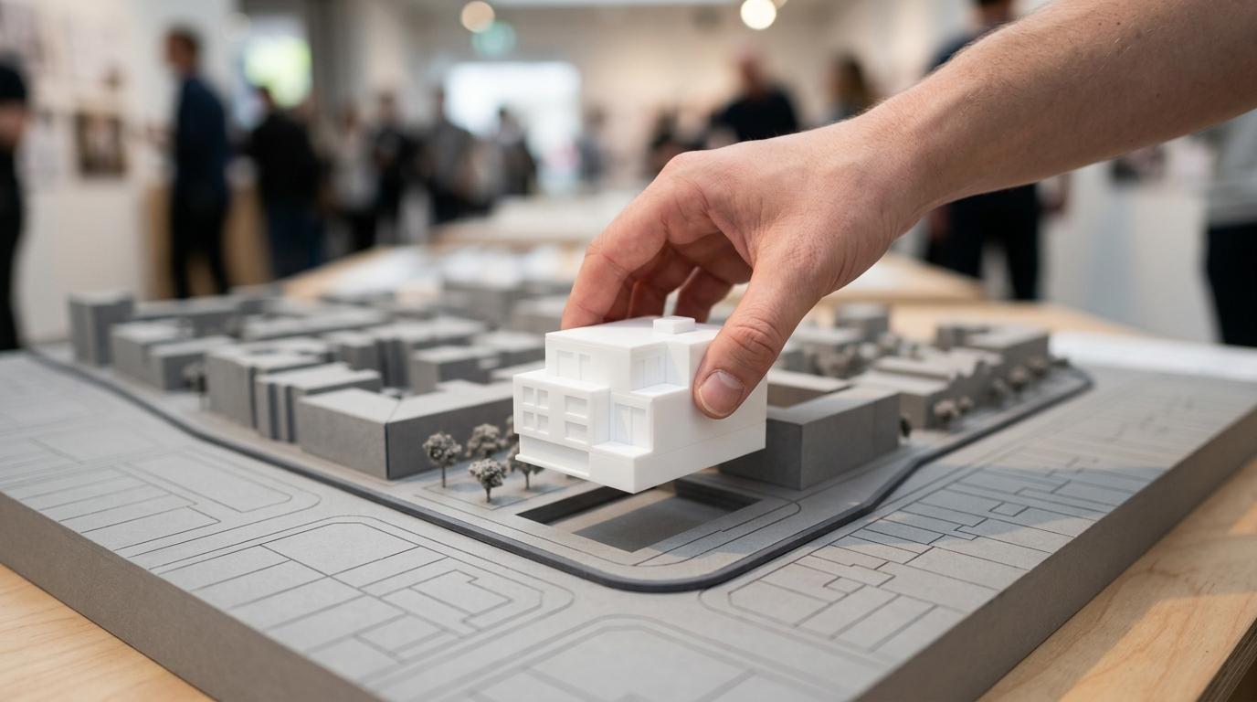
Site models are one of the clearest ways to make planning consultations understandable for non-specialists. When residents, consultees and project teams can see scale, context and proposed change in three dimensions, the discussion usually becomes more specific and more useful.
### TL;DR: Summary
* Site models work best in planning consultations when they explain scale, context and change clearly for non-specialists, rather than trying to replace statutory consultation documents or offline engagement.
* GOV.UK guidance says local planning authorities are increasingly using interactive visualisations, 3D models, digital storytelling and animations to help the public understand and explore proposals.
* The strongest consultation model types usually include urban context models, massing models, topographical models, phasing models and transport or access models, chosen to match the decision being discussed.
* Standard scales like 1:200, 1:500 and 1:1000 each answer different questions: detail at site level, surrounding massing, or wider urban context.
* Physical models and interactive 3D tools are not substitutes for each other: physical models help shared in-room discussion, while digital tools widen access and can combine maps, documents, surveys and visual content.
* A good site model should stay precise on boundaries, height, access and neighbouring context, while simplifying secondary detail that can distract from the consultation question.
Planning guidance in the UK now openly recognises the value of visual tools in public engagement. That matters because the best consultation material is not the most technical material, but the material that helps people understand what is changing, where it sits, and what trade-offs are involved.
Why are site models useful in planning consultations?
Yes. Site models and interactive visualisations help non-specialists grasp massing, access and neighbouring context faster than 2D plans alone.
GOV.UK guidance says local planning authorities are increasingly using interactive visualisations, 3D models, digital storytelling and animations to help the public understand and explore proposals. That is a practical shift, not a cosmetic one. In a consultation setting, most people are not reading plans like architects or planners do. They are trying to answer simpler questions: How tall is it? What changes on my street? How close is it to existing homes? A site model answers those questions in seconds.
A good model also changes the quality of feedback. Instead of broad objections based on uncertainty, people tend to comment on specific matters like overshadowing, building line, open space, traffic routing or landscape buffers. A common mistake is to treat the model as a display piece. Its real value is as a shared reference point that lets different groups discuss the same geometry.
"ARI Model has produced over 499 models in 17 countries since 2000 for architecture, planning and exhibition use."
When should a site model be used instead of relying on plans alone?
Use a site model when the proposal involves complex context, multiple stakeholders or hard-to-read spatial change that drawings alone will not explain well.
If the consultation concerns a simple extension on a straightforward plot, plans and elevations may be enough. If the scheme affects a town centre edge, a transport corridor, a conservation setting or a sloping site, a model usually adds real value. The more neighbours, view corridors and level changes involved, the stronger the case for a model.
There is a trade-off. Physical site models take budget, production time and transport planning. Yet they often reduce confusion, which can save time later in repeated explanation and revisions. Digital tools can support the same consultation, but GOV.UK also makes clear that digital engagement should support, not replace, statutory requirements or offline methods. So if your audience is mixed in age, access or technical confidence, a model is often the safer base layer.
What are the 8 model types for planning consultations?
The most useful site model types are chosen by consultation purpose, with urban context and massing models used most often across UK planning discussions.
Different consultation questions need different models. A design review panel may need façade and topography detail. A public drop-in event may need simpler massing and movement. Here are eight model types that cover most planning consultation scenarios.
- Urban context model: ARI Model commonly works at scales such as 1:500 or 1:1000 for wider context, where the aim is to show how a proposal sits within streets, blocks and landmarks.
- Massing or block model: Best for testing height, bulk, spacing and daylight implications without the distraction of surface finishes.
- Topographical terrain model: Useful on sloping or infrastructure-heavy sites where levels, retaining edges or cut-and-fill matter to public understanding.
- Planning application model: A balanced model that combines context, proposed form and key access information for formal or pre-application consultation.
- Phasing model: Ideal when regeneration will happen in stages and residents need to see what comes first, what stays, and what changes later.
- Transport and access model: Focuses on roads, pedestrian routes, cycle links, servicing and arrival points, often important in contentious schemes.
- Heritage and townscape model: Used where listed buildings, view cones or conservation-area relationships need careful explanation.
- Interactive hybrid model: A physical model combined with lighting, overlays or digital augmentation, useful for exhibitions and stakeholder workshops.
How do you choose the right scale for a site model?
Choose scale by decision type first, then by viewing distance, then by the minimum detail people must recognise during consultation.
Step 1 is to define the question. If people need to read entrances, landscape edges and immediate neighbouring relationships, start around 1:200. If the issue is district-scale massing or street pattern, 1:500 or 1:1000 may be better. ARI Model identifies 1:200, 1:500 and 1:1000 as standard scales for urban planning models, which mirrors normal consultation needs.
Step 2 is to set the context radius. A model that shows only the development plot can be misleading if nearby heights or routes are central to the debate. Step 3 is to trim detail to fit the scale. A common misconception is that more detail always improves understanding. At small scales, excess detail becomes visual noise.
After those choices, a simple scale rule usually works:
- 1:200: Best for plot-level relationships, entrances, landscape layout and nearby buildings.
- 1:500: Best for massing, block pattern, street edge and immediate neighbourhood effects.
- 1:1000: Best for strategic context, wider movement and land-use change.
"ARI Model builds urban planning models at standard scales including 1:200, 1:500 and 1:1000."
How do physical site models compare with interactive 3D visualisations?
Physical site models are stronger for shared room discussion, while interactive 3D visualisations are stronger for remote access, viewpoint control and layered information.
The comparison is not physical versus digital as a winner-takes-all choice. It is about task fit. A physical model is immediate, requires no interface training and lets several people point to the same element at the same time. That makes it excellent for consultation events, committee rooms and stakeholder workshops.
Interactive 3D has different strengths. GOV.UK notes that digital engagement platforms can combine maps, documents, surveys and visual content in one place. Academic research has also found that participants preferred interactive 3D visualisation over static paper-based material for public consultation, and saw it as offering more information and wider access. If people cannot attend in person, digital tools are often the only practical way to extend reach.
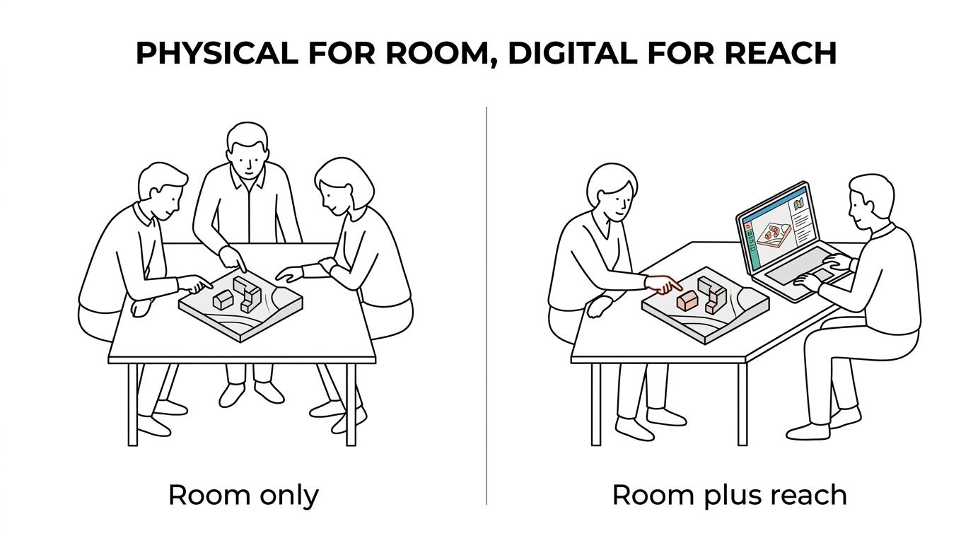
The best setup is often hybrid. Use the physical model to anchor in-person discussion, then mirror the same key content online so people can revisit it, share it and respond in their own time.
How should you prepare a site model for a public exhibition or consultation event?
Prepare the model around the consultation question, the room layout and the feedback method, not around craftsmanship alone.
Step 1 is to decide what the model must help people answer. Is the session about height, routes, landscape loss, heritage impact or phasing? That decision controls colour, labels, removable parts and viewing angles. If the model tries to answer everything, it usually answers nothing clearly.
Step 2 is to script the display. Put the model at a comfortable viewing height. Add a north arrow, scale label, legend and clear distinction between existing and proposed elements. If lighting matters, show it consistently. Pro tip: place a simple “you are here” marker for local residents. It sounds basic, but it reduces orientation problems very quickly.
Step 3 is to connect the model to feedback capture. The facilitator should know which elements are fixed, which are indicative and which are under review. That avoids the common consultation failure where a model looks final before decisions are final. Logistics matter too, including transport, installation, protection and on-site repairs.
"ARI Model provides end-to-end service from design to delivery, installation and after-sales support."
How can a site model improve public understanding without biasing feedback?
A neutral consultation model improves trust when it separates factual context from design option, and when both are easy to read.
Public understanding improves when people can decode the model quickly. That means showing existing buildings, streets and open space clearly, then making proposed intervention visible without theatrical effects. If everything is lit, coloured and polished in the same way, the eye loses the distinction between what exists and what is proposed.
The main risk is unintentional bias. Hyper-real finishes can make a scheme feel approved or inevitable. A cleaner approach is often better: muted context, clearly differentiated proposal, and labels that state what is illustrative. If there are options A and B, show both at the same scale and with the same graphic treatment. Otherwise feedback tends to reflect presentation bias rather than genuine preference.
How do you combine site models with digital consultation tools and offline engagement?
Combine them as one consultation system: physical model for in-person clarity, digital tools for reach, and offline methods for fairness and compliance.
Step 1 is to keep one core dataset. The model, boards, maps and online content should show the same site boundary, same proposal version and same assumptions. If the online image shows one massing option and the physical model shows another, confidence drops fast.
Step 2 is to use digital tools for extension, not substitution. GOV.UK says these platforms can support local plans, design codes, supplementary planning documents and site consultations, and can combine maps, documents, surveys and visual content in one place. It also says they should be used alongside offline engagement methods. That matters for accessibility and for communities with varied digital access.
ARKED notes that planning applications still hinge on a coherent drawings package—plans, sections and elevations, so visual tools should align with, not override, what is submitted for permission.
Step 3 is to standardise feedback capture. If comments come from the exhibition table, an online map and paper forms, the themes should still be coded the same way. Pro tip: match each consultation question to a model view and a survey prompt, so comments stay specific.
"ARI Model operates workshops in France and Germany with 1,000 m² production capacity for model fabrication and presentation delivery."
What information should be simplified and what should stay precise on a consultation model?
Keep boundaries, height, access and neighbouring context precise; simplify minor detail that does not affect the consultation decision.
A consultation model is not a construction model. People do not need every façade panel, bench and balustrade to understand whether a building is too tall, too close or poorly connected. Precision should be concentrated where disagreement is likely.
A practical split usually looks like this:
- Keep precise: Site boundary, building envelope, key heights, adjacent buildings, streets, access points and major landscape structure.
- Simplify: Internal layouts, material textures, signage, furniture and very fine façade articulation.
- Add only if debated: Protected trees, servicing routes, parking ratios, phasing lines, rights of way or view corridors.
A common misconception is that simplification means being vague. It does not. It means choosing which facts must stay measurable and which details can stay diagrammatic.
What mistakes reduce the value of site models in planning consultations?
The biggest mistakes are wrong scale, missing context, unclear labelling and treating the model as a standalone answer.
If the scale is too small, people cannot read the relationships they care about. If the context is cropped too tightly, the proposal can look isolated from the neighbourhood it affects. If there is no legend, no north arrow and no statement of what is existing or proposed, viewers will fill the gaps with assumptions.
Another frequent error is overpromising what the model can do. A site model is excellent at explaining massing, context and access logic. It is weaker at noise, wind, traffic counts or policy compliance unless paired with other evidence. If a consultation question depends on technical analysis, the model should point to that analysis, not pretend to replace it.
The strongest consultation setups treat the site model as one part of a wider evidence package. That is exactly where it does its best work: making spatial change visible, discussable and easier for the public to judge.