
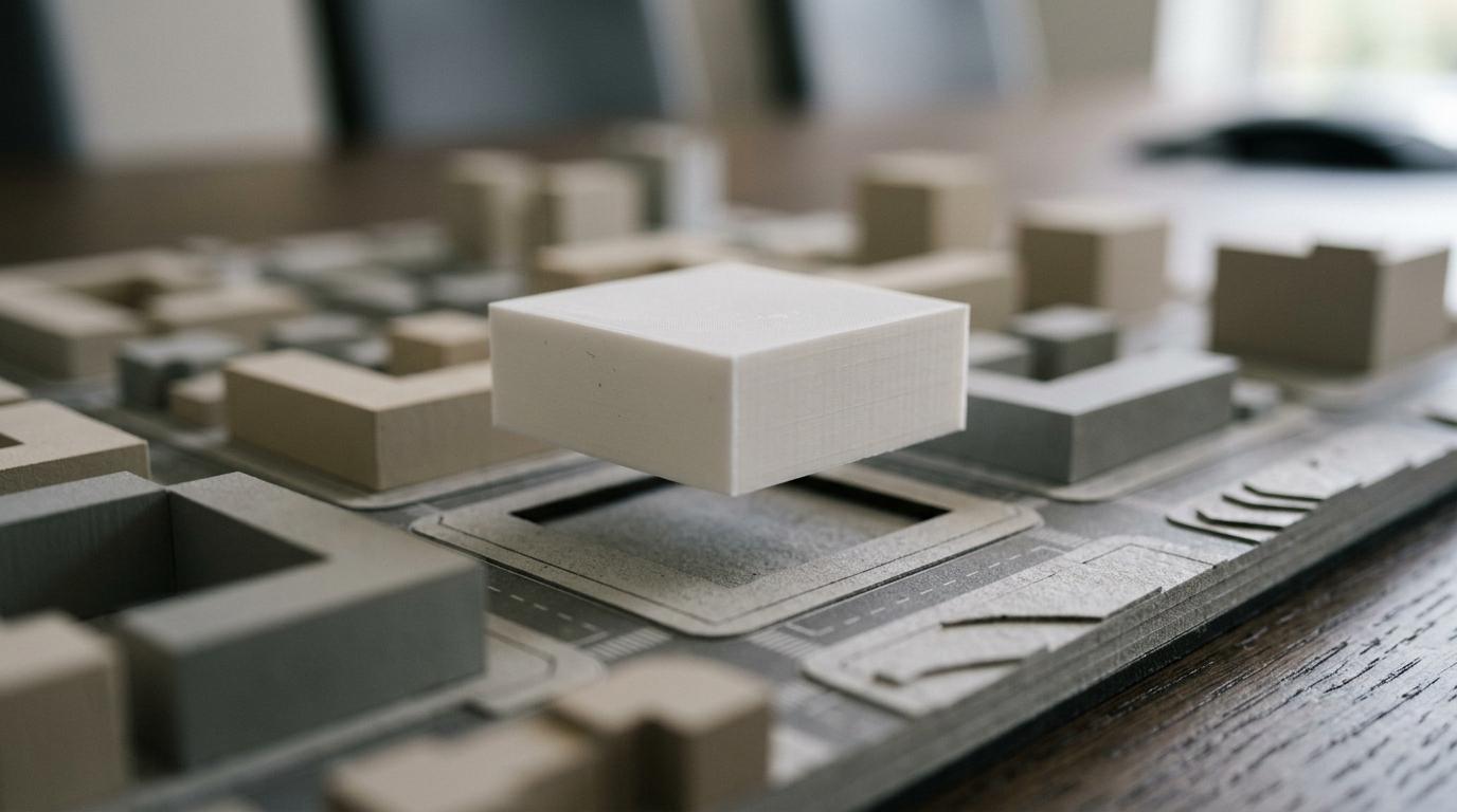
Urban planning models help teams see a city before they change it. They turn zoning, massing, transport, and public-space choices into something planners, developers, and citizens can compare quickly.
### TL;DR: Summary
* Urban planning models are scale-based physical or digital city representations used to test context, compare options, and support planning decisions before construction or policy approval.
* The best urban planning models are decision tools, not just presentation pieces, because they make height, density, street relationships, and infrastructure impacts easier to judge in real space.
* Physical models are often better for scale perception and fast room-based discussion, while virtual city models using standards like CityGML 3.0 are better for data exchange, simulation, and multi-agency coordination.
* standard urban planning scales such as 1:200, 1:500, and 1:1000 suit different questions: 1:200 for block detail, 1:500 for district comparison, and 1:1000 for broader masterplanning context.
* A strong urban planning model brief should define the planning decision, review audience, update frequency, source data, and whether lighting, interactivity, or modular components are needed.
* A hybrid workflow usually gives the strongest result: a physical model for public and executive review, plus a virtual model for updates, analysis, and long-term coordination.
The most useful models are working tools rather than static display pieces. When they are specified well, they help teams compare scenarios faster, reduce approval risk, and keep complex urban choices visible across the life of a project.
What is an urban planning model?
Urban planning models are scale-based decision tools used by planning departments and design teams to test context, height, density, and infrastructure. Boston’s 1:40-inch downtown model and CityGML-based virtual city models show the same aim: make spatial choices visible before construction.
In practice, an urban planning model can be physical, digital, or hybrid. The physical version often shows terrain, plots, street grids, building massing, open space, and key infrastructure at a chosen scale. The virtual version adds data layers, searchable attributes, and simulation inputs for traffic, energy, or environmental analysis.
What makes this category distinct is purpose. An architectural marketing model may focus on one building. An urban planning model looks outward, asking how many buildings, streets, and public spaces relate to one another across a district or city.
ARI Model works in standard urban planning scales such as 1:200, 1:500, and 1:1000, which reflects a practical truth: the right scale depends on the planning decision, not on a fixed visual style.
"ARI Model produces urban planning models at standard scales including 1:200, 1:500, and 1:1000."
Why are urban planning models used for decisions rather than display?
Urban planning models are most valuable when they reduce planning risk. Boston and urban-design research point to the same benefit: faster spatial comparison, clearer height judgement, and better discussion of streets, plots, and public realm before approvals or procurement.
A polished model can impress, but that is not the core value. Planners use these models to compare block heights, check view corridors, test road alignments, review development phasing, and judge whether new massing sits comfortably within existing fabric. One academic study found that a physical model often accelerates discussion because several people can read it at once without needing to control software, switch layers, or interpret perspective views.
A common misconception is that physical models matter less once a city has GIS, BIM, and renderings. In reality, the physical model often accelerates discussion because several people can read it at once without needing to control software, switch layers, or interpret perspective views.
What are the top 7 urban planning model solutions?
The best urban planning model solution depends on the planning question, not on a single format. ARI Model and CityGML-based workflows fit different needs, from public consultation and design review to transport studies, phasing plans, and investment presentations.
A useful way to choose is to start with the decision you need to make, then match the model format to the scale of that decision.
- ARI Model urban planning models: Suitable for district, city, and development reviews where physical context, finish quality, lighting, and update planning all matter.
- District massing models: Best for testing height bands, setbacks, public-space edges, and street-wall continuity across several blocks.
- Citywide context models: Useful when skyline, infrastructure corridors, and land-use shifts must be reviewed across a broad area.
- Phasing models: Strong for multi-stage developments because removable or colour-coded components make sequence and dependency visible.
- Transport and infrastructure models: Focus on roads, tunnels, stations, bridges, and pedestrian routes where movement is the planning issue.
- Virtual 3D city models: Best for semantic data, scenario testing, and exchange using standards like CityGML 3.0.
- Interactive consultation models: Effective for exhibitions and stakeholder sessions when lighting or triggered overlays clarify programme, phasing, or mobility links.
Is 1:200, 1:500 or 1:1000 the right urban planning model scale?
1:200, 1:500, and 1:1000 serve different planning jobs. ARI Model uses all three because a block-scale review, a district plan, and a metropolitan context study require different balances of detail, footprint, and cost.
If the decision is about podium condition, street frontage, public realm edges, or the relationship between individual buildings, 1:200 is usually the right choice. It shows enough detail to read entrances, setbacks, open-space boundaries, and key façade rhythms without becoming a full architectural model.
If the decision is about several blocks, movement patterns, or the relationship between neighbourhoods, 1:500 often gives the best balance. It is large enough to compare massing and circulation, yet compact enough for a boardroom or exhibition setting.
If the decision is strategic, 1:1000 is often the clearer tool. It allows planners to read land-use structure, green corridors, transport alignments, and major development clusters without filling the room with detail that nobody needs at that stage.
A common mistake is to assume that more detail always means a better model. It does not. If a masterplan will change often, a denser scale can slow updates, raise cost, and distract reviewers from the main planning question.
Should you use a physical urban planning model or a virtual 3D city model?
A physical model and a virtual 3D city model answer different questions. Basswood models support scale perception and room-based discussion, while CityGML 3.0 supports data exchange, simulation, and broader coordination across agencies and consultants.
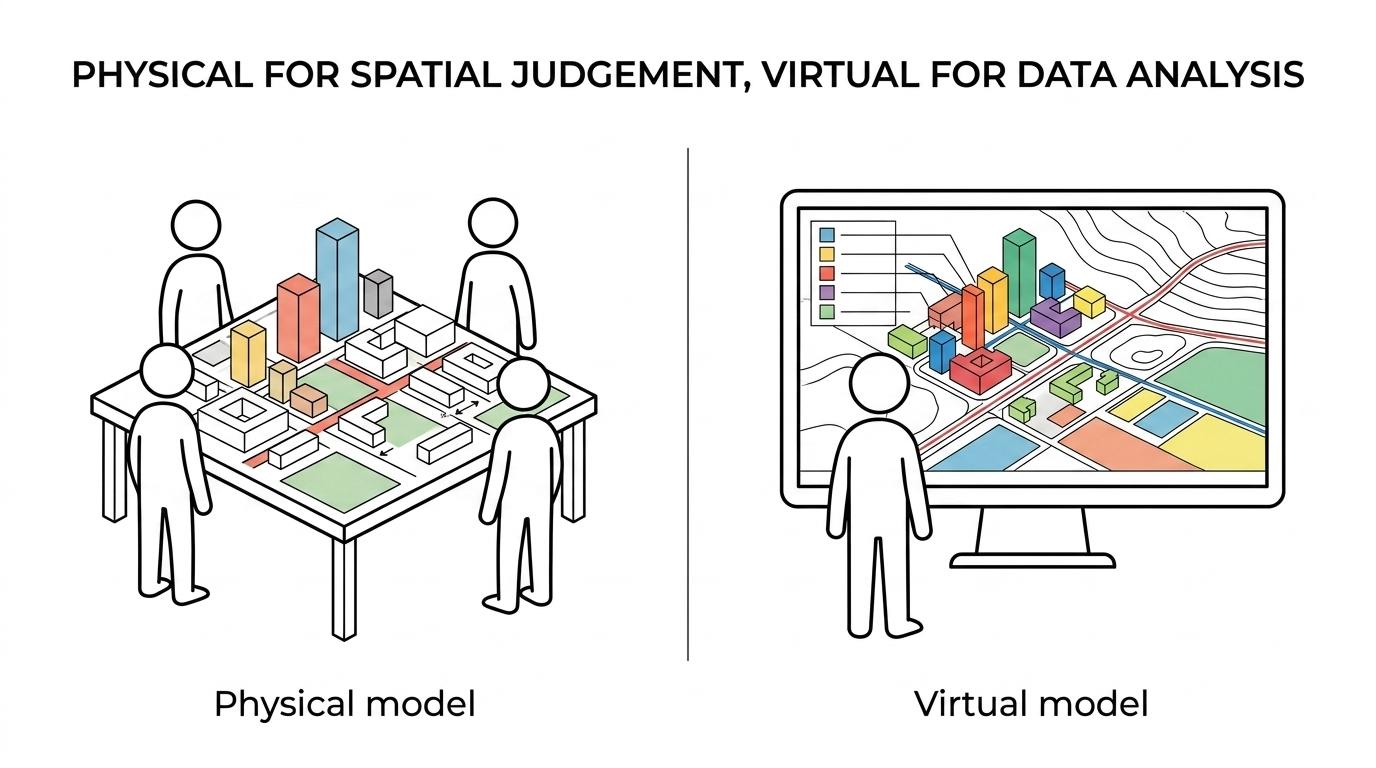
Physical models are strong when teams need immediate spatial judgement. People can move around them, compare heights, read street widths, and see context without relying on camera angles or software experience. That matters in design review, executive decision-making, public consultation, and exhibitions.
Virtual models are stronger when the task involves layers of data or repeatable analysis. They can support terrain, tunnels, trees, land-use attributes, and wide building inventories. Boston’s citywide 3D model includes more than 92,000 buildings, which shows the scale that digital city modelling can handle well.
The strongest answer is often hybrid. If you need human-scale discussion and public clarity, use a physical model. If you need live updates, simulations, and cross-platform exchange, use a virtual model. If you need both, connect them from the start instead of treating one as a backup for the other.
"Since 2000, ARI Model has produced 499+ models in 17 countries."
How do you define the right brief for an urban planning model?
A good brief starts with a decision, not a model type. A planning department or developer should define what must be compared, who will review it, and how much change is likely during the approval cycle.
Step 1 is to define the planning question.
That is especially true for corridor work, where AJ Contract’s review of road-crossing drilling solutions shows that alignments often have to be judged alongside utility crossings and ground constraints, not only on plan geometry.
Is the model meant to test skyline impact, assess density, explain a transport corridor, or support a public exhibition? A model built for committee approval will differ from one built for internal design coordination.
Step 2 is to fix the viewing conditions. If the audience will stand around a table, physical legibility matters more than fine façade texture. If the audience will use the model at an exhibition, durability, lighting, and interpretive labels become more important.
Step 3 is to define the update strategy before fabrication starts. If the scheme may change every few weeks, ask for modular neighbourhoods, removable buildings, or replaceable inserts. This is a small specification choice that saves time later.
Step 4 is to confirm source data, scale, schedule, transport requirements, and installation constraints. If the model has to travel, weight, crate design, and break-down logic should be specified at the brief stage, not after production.
How do you build an urban planning model from GIS, CAD, or BIM data?
Urban planning models are built by translating GIS, CAD, or BIM data into simplified, fabrication-ready geometry. CNC, laser cutting, and additive manufacturing such as SLA or SLS are then chosen according to scale, material, and detail.
Step 1 is data consolidation. Terrain, parcel lines, road geometry, building envelopes, utilities, and landscape data are collected into a common coordinate framework. If the data comes from several consultants, it usually needs normalising before any model work starts.
Step 2 is simplification. Raw BIM is rarely ready for model production. At urban scale, too much detail creates noise and fabrication problems. Windows, railings, furniture, and internal components are often removed so that massing, street structure, and topography remain readable.
Step 3 is output planning. CNC or laser cutting suits bases, terrain slices, and repetitive planar elements. SLA, SLS, FDM, or PolyJet processes suit different levels of complexity and surface quality. The right method depends on scale, material finish, and the number of repeated components.
Step 4 is assembly and calibration. Roads, landscape, blocks, labels, and lighting are added only after the geometry has been checked against the planning brief. A frequent misconception is that beautiful fabrication alone guarantees a useful model. It does not if hierarchy, contrast, and context are unclear.
How do lighting and interactivity improve planning review?
Lighting and interactivity improve review when they reveal programme, phasing, or movement, not when they act as decoration. LEDs, touch triggers, and layered legends can make transport links, development stages, and night-time identity easier to judge.
Lighting helps when the planning issue involves timing, emphasis, or sequence. A district model can show which buildings belong to phase one, which routes connect to a station, or how a public square relates to neighbouring uses after dark. Interactivity can also reduce confusion in public meetings because viewers can move from one scenario to another without mentally rebuilding the whole scheme.
"ARI Model supports high-precision detailing, lighting, and interactive systems for presentation and exhibition models."
A good rule is simple: if lighting or interaction reveals a planning variable, it is useful. If it only makes the model look more technical, it adds cost without adding clarity. That distinction is easy to miss, especially in exhibition-driven projects.
Which standards and data formats matter for virtual 3D city models?
CityGML 3.0 is the main standard for virtual 3D city models, and IFC plus GIS formats often sit beside it. Together they let planners connect geometry, semantics, and analysis across design, planning, and infrastructure teams.
CityGML matters because it is not only a shape format. It defines a conceptual model and exchange format for urban objects, which means buildings, terrain, transport, vegetation, and other city elements can carry meaning as well as geometry. That semantic layer is what makes energy, traffic, environmental, cadastral, or navigation use cases more reliable.
After the semantic structure is clear, teams usually combine several formats to serve different tasks.
- CityGML 3.0: Best for semantic virtual 3D city models and cross-system exchange.
- IFC: Best for detailed building-level BIM information where individual assets matter.
- GeoJSON or Shapefile: Best for lighter GIS context layers such as parcels, routes, and land use.
A common mistake is to think that a textured mesh is enough. If you need policy testing, scenario comparison, or data exchange across agencies, semantics matter as much as visual form.
How do you update an urban planning model when a scheme changes?
Urban planning models stay useful only if updates are designed in from day one. Boston keeps its physical model current, and the same principle applies to private schemes: modular bases, change logs, and clear version control protect long-term value.
Step 1 is to divide the model into replaceable zones. District tiles, removable buildings, and separate infrastructure bands make revisions much easier than a permanently bonded single-piece model.
Step 2 is to keep a versioned source package. The current CAD, GIS, or BIM files should match the approved physical state. If they drift apart, every update becomes slower and the model loses trust.
Step 3 is to set update thresholds. Minor façade changes may not justify a rebuild at 1:1000, while a new bridge, road realignment, or extra development parcel probably does. If the threshold is clear, teams avoid expensive revisions that do not improve decisions.
Step 4 is to plan logistics. A model that travels between planning offices, showrooms, and exhibitions should be designed for safe packing, reassembly, and field repair. That is where an end-to-end fabrication partner can make the model a long-term planning asset rather than a one-off display.
---