
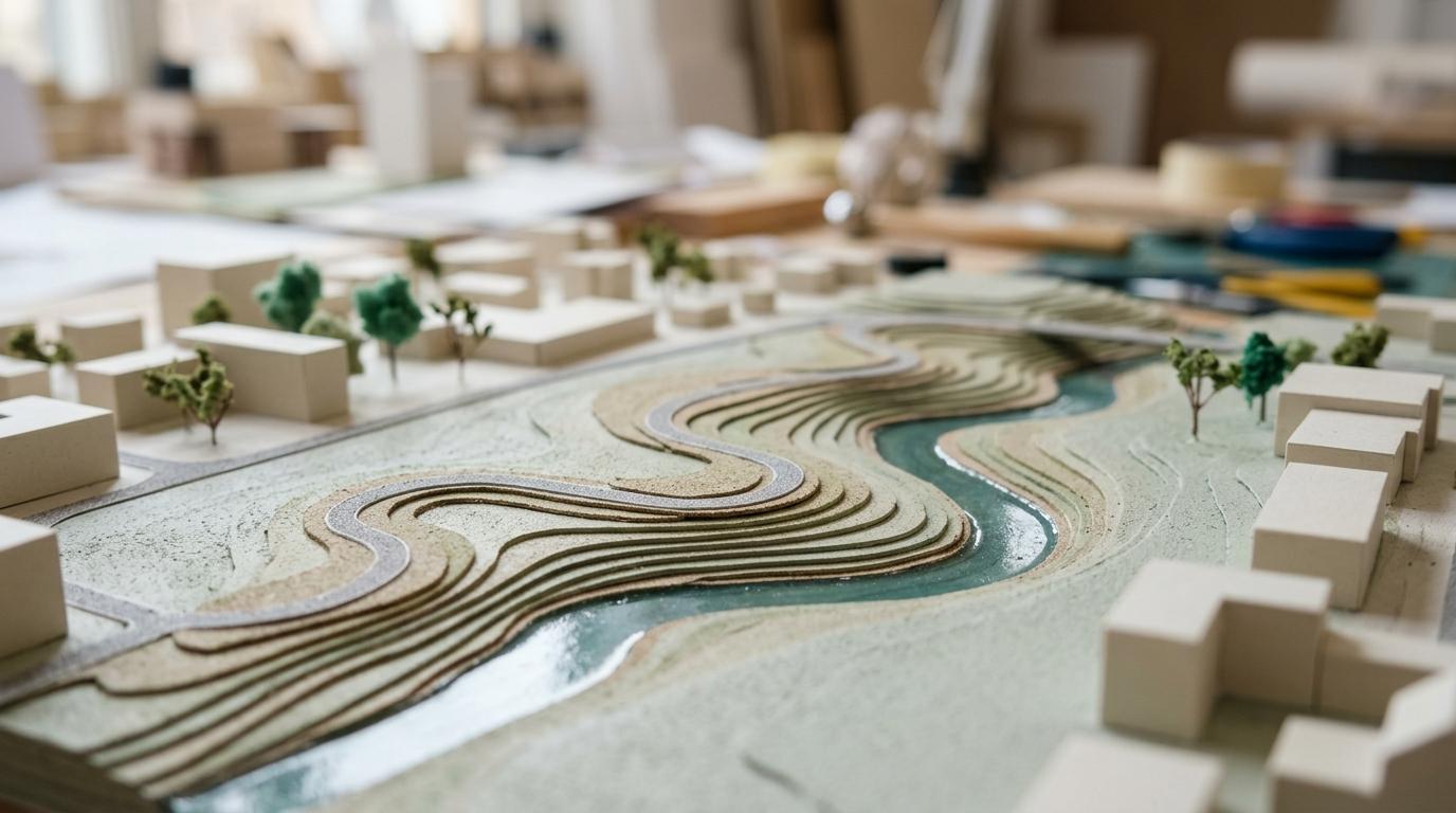
When a UK design project depends on people understanding landform, movement and context quickly, a flat drawing is rarely enough. A landscape model lets you show topography, water, routes, public realm and built form in one physical object that clients, planning teams and stakeholders can read at a glance.
ARI Model designs and fabricates landscape models as part of its architectural and masterplan models modelling service for architects, real estate developers, urban planners, construction and engineering firms, and exhibition teams across Europe and worldwide. Since 2000, ARI Model has produced 499+ models in 17 countries, supported by 1,000 m² of workshop capacity in France and Germany and advanced CNC, laser and 3D printing equipment.
Landscape models for UK architects, developers and urban planning teams
For UK project teams, the value of a landscape model is not only visual impact. You often need to explain how a scheme sits within its wider terrain, where key routes run, how water and public realm connect, and what people will understand first in a planning meeting or consultation setting.
ARI Model builds landscape and masterplan models that help planning teams, investors, buyers and public stakeholders understand massing, routes, neighbourhood fit and future phases at a glance. That makes the model useful in design reviews, client presentations, exhibitions and stakeholder discussions, not just on a display plinth.
"ARI Model has produced 499+ models in 17 countries since 2000."
If you are coordinating architects, planners, engineers and client-side decision makers, ARI Model gives you one physical reference point that can reduce explanation time and make spatial relationships easier to discuss.
Landscape models are especially useful when your team needs to present:
- Planning and design review material for complex sites
- Masterplans with public realm, phased development or mixed-use plots
- Investor and client presentations where context must be clear quickly
- Exhibition and consultation displays that need to communicate to non-technical audiences
ARI Model landscape and masterplan models show the site elements people need to understand
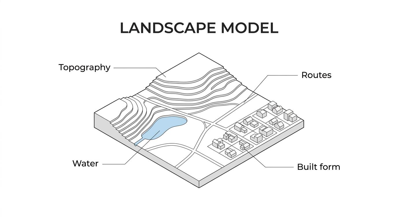
ARI Model’s urban planning models capability can include streets, plots, public realm, landscape, water, topography and key view corridors. For landscape-led developments, that means the model can show much more than building massing. It can communicate how terrain, open space and movement structure the whole proposal.
Where a project needs clearer storytelling, ARI Model can also integrate illuminated and interactive systems to highlight routes, amenities, plots, building groups or development phases. For teams presenting multiple scenarios or staged delivery, that makes the model easier to use in live conversations.
"ARI Model produces urban planning models at scales such as 1:200, 1:500 and 1:1000."
The right level of abstraction depends on the decision you need the model to support. ARI Model can help you choose between a cleaner massing-led presentation and a more descriptive landscape model that brings out site structure and topography.
Typical landscape model content can include:
- Terrain and topography, including contour changes and landform
- Water features, streets, plots, public realm and development parcels
- Key view corridors and the scheme’s relationship to its surroundings
- Lighting or interactive emphasis for phases, routes or featured zones
Physical landscape models improve stakeholder engagement and planning communication
A landscape model becomes more valuable when it helps different audiences understand the same proposal for different reasons. Design teams may focus on spatial hierarchy and site constraints, while clients may need to grasp commercial phases and public stakeholders may need a clearer sense of access, scale and neighbourhood fit.
That communication role is well recognised in planning research. A 2023 review in Landscape and Urban Planning describes 3D visualisations as communicative tools across architecture, landscape architecture and land-use planning. ARI Model applies that same principle in physical form, giving your project team a model that supports discussion, comparison and explanation.
"ARI Model can show landscape, water, topography and key view corridors in one masterplan model."
For UK schemes moving through planning, public consultation or investor review, that matters. ARI Model’s landscape models help people understand the urban fabric, landform and circulation patterns at a glance, which can make meetings more focused and reduce the risk of key spatial points being lost in drawings alone.
ARI Model production methods for landscape models: precision, scale and presentation control
Landscape models are only useful if the information is readable and the build quality supports the design intent. ARI Model combines craftsmanship with contemporary production methods, including CNC machining, laser cutting and FDM, PolyJet, SLA and SLS processes. That gives your team practical options for accurate terrain, repeatable building components, precise route networks and presentation-grade detailing.
ARI Model’s urban planning models are commonly produced at 1:200, 1:500 and 1:1000 scales, depending on site size and communication needs. If the goal is to focus attention on massing and geometry, we can work with a neutral white scheme that keeps visual emphasis on spatial relationships. If the brief requires a more descriptive landscape reading, we can shape the model around topography, water and public realm hierarchy.
The benefit for you is control. ARI Model can tailor scale, detail level, illumination and interaction to the audience you need to influence, whether that is a design jury, planning team, investor group or exhibition visitor.
End-to-end landscape model delivery for UK project deadlines
UK teams often need more than fabrication. You may need a modelmaker who can move from design files to finished presentation object, then manage delivery, installation and follow-up support without fragmenting responsibility across suppliers.
ARI Model offers an end-to-end service from design and fabrication through illumination, delivery, installation and after-sales support. With workshops in France and Germany totalling 1,000 m², ARI Model has the production capacity to handle both detailed one-off landscape models and larger presentation programmes for exhibitions or phased development launches.
"ARI Model supports production through 1,000 m² of workshops in France and Germany."
Budget and timeline decisions usually come down to a few practical variables: scale, detail level, lighting or interaction, transport constraints and the setting in which the model will be shown. ARI Model helps you define those choices early, so the model suits the decision-making job it needs to do rather than carrying unnecessary cost or detail.
When ARI Model is the right fit for your landscape model project
ARI Model is a strong fit when your team needs a landscape model that does clear communication work, not just visual decoration.
You are likely to get the most value from ARI Model when:
- You need to explain topography, water, movement and built form together
- Your project must be understood by both technical and non-technical stakeholders
- You want lighting or interactive elements to clarify phases, routes or development parcels
- You need an experienced international model manufacturer with delivery capability across Europe and worldwide
If your UK team is preparing a landscape-led development, masterplan, competition entry or stakeholder presentation, send ARI Model your site plans, topographical information, CAD or BIM files, and presentation brief. We can help you define the right scale model for clearer planning communication, stronger presentations and better-informed project discussions.