If you need a topographical model for a UK planning project, the value is not just in showing the landform. You need a model that helps people understand the site quickly, supports planning evidence, and makes technical issues such as contours, waterways and flood context easier to discuss. ARI Model builds topographical models for planning, masterplanning and consultation work, combining terrain accuracy with presentation-grade fabrication.
Since 2000, ARI Model has designed, fabricated, illuminated and delivered architectural and industrial scale models across Europe and worldwide. For UK architects, developers, urban planners, construction teams and engineering firms, we turn survey data, contour information and hydraulic studies into physical models that make a site easier to assess, present and defend.
ARI Model topographical models for UK planning consultations, masterplans and design-code evidence
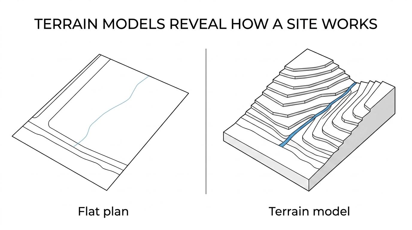
A flat plan can show boundaries and annotations, but it rarely explains how a place actually works. ARI Model topographical models help you present slope, level changes, site edges, surrounding context and development constraints in a form that planning officers, stakeholders, design teams and community audiences can read at a glance.
That matters in UK planning. Design-code baseline work can include topographical, geology, ecology, river, waterway and flood risk evidence, so the physical model needs to do more than look impressive. ARI Model builds topographical and masterplan models that support those place-based discussions with a clear, physical reference point.
“Since 2000, ARI Model has produced 499+ models in 17 countries for presentation, planning and exhibition use.”
For consultation work, a strong topographical model also improves communication. UK guidance on digital community engagement notes that digital tools can improve how proposals are presented and support wider participation. A physical model gives your team a reliable centrepiece for meetings, exhibitions and photographed consultation visuals, especially when the site is difficult to understand from drawings alone.
Depending on the project, ARI Model can produce topographical models at broader scales such as 1:1000 to cover a larger planning area, or at closer scales where landform and proposed development relationships need more emphasis. The right scale is driven by what you need to prove, who needs to understand it, and where the model will be used.
A UK planning model can be configured to make specific evidence easier to read, including:
- Contour levels, cut and fill relationships, and overall landform
- Watercourses, flood-sensitive areas, and hydraulic context
- Existing buildings, infrastructure, roads, bridges and development parcels
- Proposed masterplan elements that need to be seen within the terrain, not separate from it
ARI Model helps UK planning teams assess terrain, water flow and site suitability
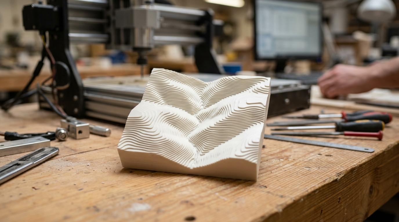
ARI Model describes a topographic model as a representation of natural terrain based on a hydraulic study. In planning terms, that gives you a practical way to show how the site behaves, not just where it sits on a map. We use topographical model making to represent terrain and support discussions around water flow, contour levels, flood levels and site suitability.
“ARI Model uses topographic or hydraulic models to represent terrain contours and water flow, with scales such as 1:1000 used for larger areas.”
This is especially useful when the planning question depends on the land itself. If your project involves sloping sites, waterways, bridge relationships, edge conditions, access routes or flood-sensitive development, the model becomes a working tool for design reviews, consultation events and internal approvals.
ARI Model also helps when the same model needs to serve more than one purpose. A topographical model can support early planning conversations, then move into client presentations, public exhibitions or marketing environments once the scheme progresses. That gives you more value from a single piece of model work.
ARI Model manufacturing capacity for reliable topographical model delivery to the UK
Complex planning models need more than craft skill. They need production capacity, file handling, precise machining and a team that can deliver to a fixed deadline. ARI Model supports this with 1,000 m² of workshops across France and Germany, including 600 m² in France and 400 m² in Germany.
“ARI Model works from 1,000 m² of workshops in France and Germany, with its third workshop opened in Germany in 2023.”
That production base matters when your model includes demanding terrain geometry, multiple material finishes, lighting or a tight exhibition date. ARI Model uses CNC, laser cutting and advanced 3D printing processes including FDM, PolyJet, SLA and SLS, so your model can be fabricated with the level of detail the planning task actually requires.
You also get an end-to-end service. ARI Model handles design, fabrication, illumination where needed, delivery, installation and after-sales support. For you, that means fewer handovers, clearer responsibility and a more manageable route from raw site data to finished model.
What you can expect from ARI Model during a UK planning model project
A useful topographical model starts with the right inputs and the right brief. We work around your planning purpose first, then define the scale, scope and level of detail that will help you present the scheme clearly without adding unnecessary complexity or cost.
In practical terms, ARI Model will usually need your available site information, proposed use of the model and key deadline. That often includes survey drawings, CAD files, GIS or contour data, a hydraulic study where relevant, and clarity on whether the model is for planning committee review, public consultation, a design-code workshop, a client presentation or an exhibition.
If your model needs to support more than one audience, we plan for that early. ARI Model can produce presentation-focused topographical models with high-precision detailing, and where the brief calls for it, we can incorporate interactive systems to direct attention to the parts of the proposal that matter most during review.
When ARI Model is the right fit for UK developers, architects and urban planning teams
ARI Model is a strong fit when your project needs terrain evidence to be understood quickly by non-technical and technical audiences at the same time. That is often the case in planning environments where committees, communities, clients and consultants all need to read the same site differently.
You are likely to get the most value from ARI Model if your project involves one or more of the following:
- A planning or masterplan submission where terrain, waterways or flood context affect the design case
- A design-code baseline or place analysis that needs topographical evidence presented clearly
- A public consultation or exhibition where site levels and landform are hard to explain on boards alone
- A scheme with a fixed presentation date, installation requirement or cross-border delivery need
If you only need a very simple internal study model with minimal presentation requirements, a lighter solution may be enough. If you need a topographical model that has to inform planning discussions and present well in front of decision-makers, ARI Model is built for that level of work.
Send ARI Model your topographical model brief for a UK planning project
If you are preparing a UK planning submission, consultation event or masterplan review, ARI Model can help you turn terrain data into a model that makes the site easier to understand and the proposal easier to present.
Send us your site information, preferred scale, planning stage and deadline. ARI Model will review the brief with you and define a topographical model approach that fits your planning objective, presentation setting and delivery programme.